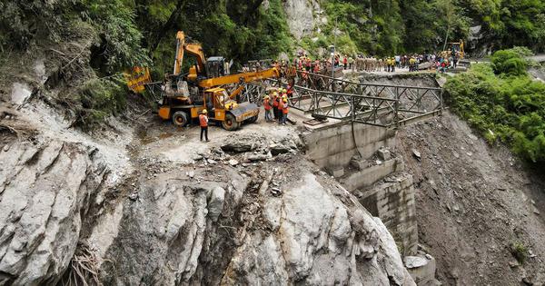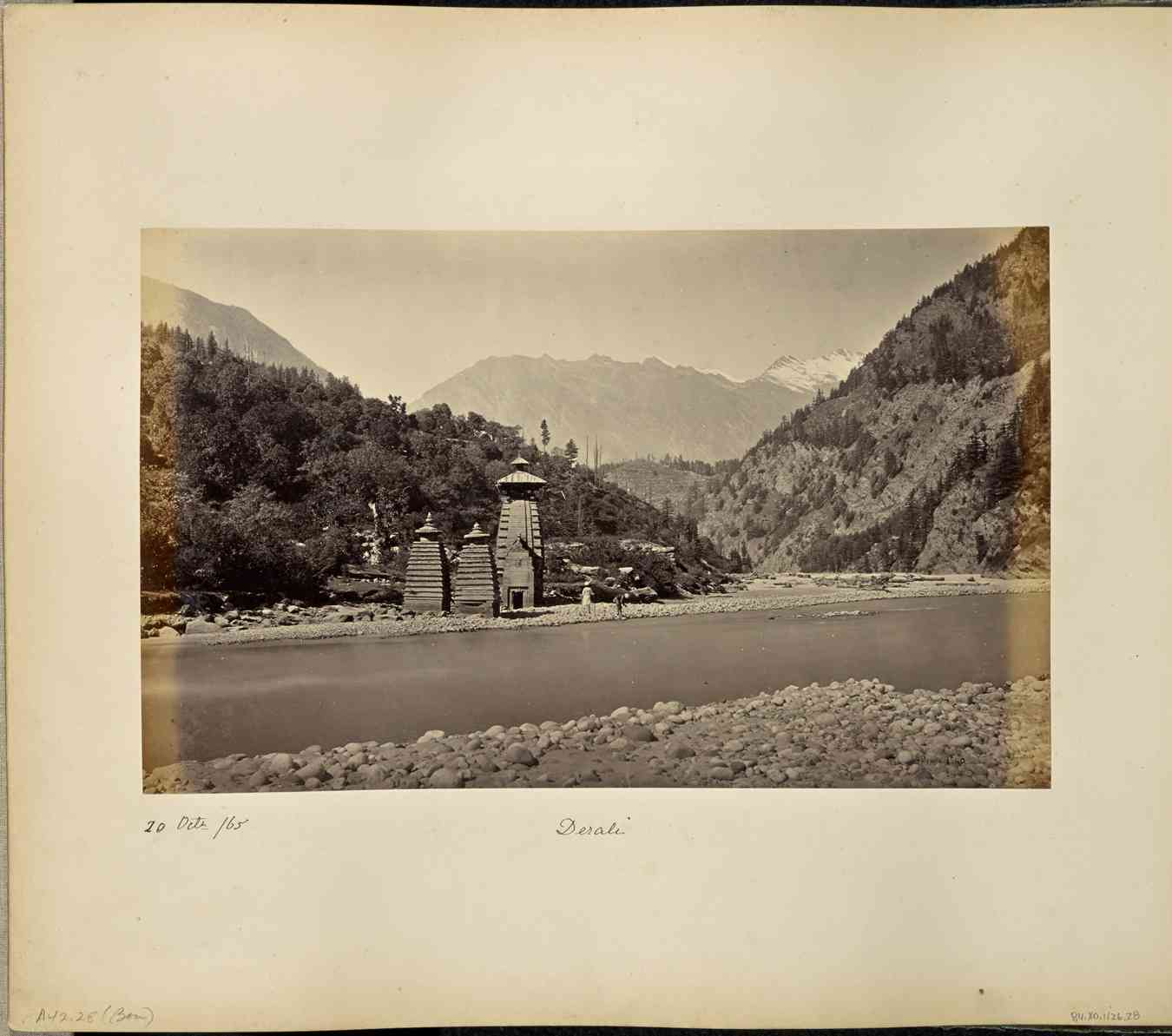
On the afternoon of August 5, a mass of water surged down the Kheer Ganga stream, a tributary of the Bhagirathi, carrying with it boulders, mud and shattered timber.
Within seconds, the market settlement of Dharali in Uttarkashi was swept away.
A compilation of videos gathered by the local news outlet Baramasa showed the disaster occurring in six distinct waves of water and debris – each successive wave buried more of the town until the market lay smothered beneath mud and rubble estimated at between 40 and 50 feet deep. This depth made recovery and rescue efforts painfully slow.
By the evening, at least four people were confirmed dead, though many more remained missing, presumed buried under the wreckage of buildings and the heavy sediment that covered the town. According to a ground report by Baramasa, eyewitnesses claimed that “over a hundred must have been lost”, including hotel workers and daily-wage labourers who had been in the market area. “Many got buried in front of our eyes,” one resident recalled.
More than two weeks later, even as rescue operations continue, only one body has been recovered, though local officials now list 69 as missing. Rescue teams have airlifted approximately 1,400 people from nearby areas, and the government has confirmed that around 150 hotels and homestays, as well as several other establishments, and apple orchards, have been destroyed.
Meanwhile, the precise cause of the flood is yet to be determined. Rainfall in the preceding days had not been unusually heavy, leading some scientists to suggest that the disaster may have been caused by a glacial lake outburst.
However, a preliminary report submitted to the union home ministry suggested it may have had a more complex trigger. The report noted that the primary event may have been a landslide lake outburst flood, or LLOF – a landslide lake refers to one that is formed when landslide debris dams a river. This, the report suggested, triggered a chain reaction among several smaller lakes upstream of Dharali, which had formed over the past few decades as a result of accelerated snowmelt, which in turn resulted in the massive flash flood.
The report did not, however, rule out the possibility that a combination of other factors may also have contributed to the disaster. These potential factors included a fresh landslide, an avalanche, or a small-scale glacial lake outburst flood.
But even as the government and experts attempt to understand the causes of the disaster, an aspect of it has received relatively less attention: how the current pattern of development in the area led to significantly higher destruction and a greater number of deaths. This pattern involves unrestrained construction as a path to supposed economic progress, without taking into account the natural limitations of the fragile landscape.
The prevalence of this pattern is evident from the fact that the destruction was concentrated in the Dharali market: a cluster of new homestays and commercial buildings that had sprung up in recent years. The older Dharali village, perched higher on the slope, suffered far less damage.
Dharali is only one such example of a site in the region that has seen poor planning. A similar development model, which prioritises rapid construction that does not take into account the region’s inherent fragilities, prevails across the wider Himalayan region, exposing vast populations to an escalating risk of catastrophe.
The fragility of the Himalayas
The Himalaya range is one of the most seismically active regions on the planet – it was formed and continues to be shaped by the convergence of the Indian and Eurasian tectonic plates.
Geologists note that the regional thrusts or deep geological fractures that define the range are themselves fragmented by numerous local faults.
These weak zones produce a high frequency of landslides and slope failures, particularly in the steep terrain along river valleys. Climate change, which has also resulted in erratic rainfall patterns, accelerated snowmelt, and intensified runoff, has only further compounded this instability.
The region also faces a high risk of flash floods. Its V-shaped valleys act as natural funnels, channelling water runoff into narrow riverbeds where the flow accelerates to dangerous speeds. During a flood, water typically scours the slopes as it descends, tearing away soil, boulders and vegetation until it transforms into a thick, roaring wall of debris.
Uttarakhand, in particular, has endured a long history of such events. The most catastrophic instance in several decades was that of the Kedarnath floods of 2013, in which more than 6,000 died, 100,000 were stranded, and roads, bridges, and at least 30 hydropower projects were swept away. More recently, in the Chamoli disaster of 2021, 72 lives were confirmed lost, and more than 200 people went missing, while damage to infrastructure was estimated at ₹1,500 crore.
Putting populations at risk
While the region has seen frequent and widespread devastation, these events are not random phenomena – rather, they adhere to discernible and often predictable patterns.
A recent study of the entire Himalayan arc, from India to Nepal and Bhutan, found that between 1992 to 2022, an average of 86% of the landslides each year occurred at sites where they had previously occurred. Of these, there were two kinds. Most were persistent and were active every year – these accounted for between 55% and 83% of the total affected area each year. Others were reactivated, and occurred on older, dormant slide zones – these accounted for between 3% and 24% of the affected area each year.
The study also found that, even where slopes appeared to recover, as indicated by visible vegetation regrowth in satellite images, this healing was often temporary. While such apparent recovery was seen in roughly a quarter of the cases studied, more than half of these seemingly stable areas collapsed again in a fresh landslide within a mere five years from the start of their recovery period.
Worryingly, as other research has indicated, development patterns in the region have not been planned around these clear patterns of risk.
Instead, driven by tourism and seasonal migration, Himalayan towns have swelled beyond their carrying capacity, forcing expansion into the most hazardous tracts. Research by PC Tiwari and others between 2001 and 2011 documented a 6% increase in those inhabiting known landslide-prone slopes. The study also noted a 14% increase in populations living on vulnerable lower river terraces – the first to be consumed by flash floods – and an 8% rise in settlements on steep gradients.
Increasing infrastructure work
The government’s failure has not only been in allowing settlements in vulnerable areas – it has also exacerbated risk by carrying out massive infrastructure projects, particularly road construction, in the region.
Indeed, in recent years, Uttarakhand has seen an explosive pace of road construction: between 2010 and 2014, just 144 km of new roads were laid; between 2014 and 2018, that figure soared to 846 km. Much of this activity is driven by flagship undertakings such as the Char Dham National Highway Development Programme, an initiative to build a 900-km network of wide, two-lane highways connecting the state’s primary pilgrimage sites. In executing such projects, proponents often slice wide carriageways into unstable hillsides, and the discarded spoil from these projects is dumped into riverbeds and side channels, clogging the waterways and priming them for higher intensity, deadlier floods.

In one instance, researchers identified a landslide hotspot in Tehri Garhwal, Uttarakhand, which saw significant cutting into cultivated hillsides to widen National Highway 7 – this activity was found to be linked to extensive slope collapses at the site. In fact, the study noted that at the scale of analysis it was conducting, “the landslide impacts of road building are comparable in intensity to those associated with earthquakes”.
GLOFs and LLOFs
Meanwhile, the risks to those who live in the mountains continue to grow. These include risks from glacial lake outburst floods, or GLOFs, as well as landslide lake outburst floods, or LLOFs, which have received relatively less attention.
Recent decades have seen the risks of GLOFs multiply. A comprehensive study of the Hindukush–Karakoram–Himalaya region found that the total number of mapped glacial lakes grew from 17,641 in 1990 to 19,284 in 2020 – a 9.3% increase – while their combined area expanded by more than 10%. The upper Ganga basin recorded the fastest growth: lake numbers here rose by over 22%, and their surface area by nearly 24%. Scientists link this acceleration directly to above-average warming rates in the Himalaya, which are driving a rapid retreat of glaciers.
The dangers GLOFs present are immense – among the most devastating factors of the June 2013 Kedarnath floods was the collapse of the moraine dam of Chorabari Lake.
Landslide lake outburst floods also present grave risks. The very composition of a landslide dam, which includes loose, unconsolidated material with little structural integrity, is a key factor in the risk of such floods. As dammed water accumulates, the growing hydrostatic pressure tests the limit of this fragile barrier.
The scale of destruction caused by such floods is usually determined by how soon these dams breach: while some collapse within hours, releasing limited volumes of water, those that persist for days or weeks store vastly larger quantities of water, so that when they collapse, they cause catastrophic damage.
Uttarakhand is immensely vulnerable to such floods. Researchers at the Indian Institute of Technology Roorkee found that numerous rivers in the state were vulnerable to landslide damming – the Alaknanda the most so, followed by the Mandakini, Dhauliganga and Bhagirathi. Within the state, Chamoli district was found to be the most affected by LLOFs, followed closely by Rudraprayag – both districts part of Alaknanda’s catchment areas – and Uttarkashi. The study cites an earlier study which found that “the major floods in the Alaknanda catchments were caused by the landslide dam outburst rather than the glacial lake outbursts”.
The phenomenon is far from new – as far back as 1893, when a massive landslide dammed the Birahi Ganga river, the region saw the formation of the Gohna Lake, one of the largest lakes in the Garhwal-Kumaon region at the time. The lake experienced a partial breach in 1894, unleashing a catastrophic torrent on the valley downstream. It completely washed away the historic town of old Srinagar Garhwal, situated on the river’s banks.
This distinction between these two categories of floods is more than academic – authorities need to treat landslide-dammed lakes as a separate and pressing hazard, and formulate strategies to tackle them. For instance, as some experts have noted, they need to identify potential landslide zones where there is a risk of dam formation and monitor these sites regularly, apart from evaluating risks to downstream communities.
The tragedy at Dharali is the predictable outcome of a development paradigm fundamentally at odds with the Himalayan landscape. This paradigm rests on a perilous oversight: of the fact that much of the region’s new infrastructure is being planted squarely atop geological and hydrological fault lines. The continuing lack of attention to this aspect of the problem suggests it is only a matter of time before another torrent of water and debris unleashes another spell of devastation.
This article first appeared on Scroll.in
📰 Crime Today News is proudly sponsored by DRYFRUIT & CO – A Brand by eFabby Global LLC
Design & Developed by Yes Mom Hosting


